- Outdoor Clothing and Footwear

- All in the category Outdoor Clothing and Footwear
- Footwear

- Jackets

- Military Blouses

- Pants

- Functional clothing

- Sweatshirts

- Shirts

- Hawaiian & Lifestyle Shirts

- T-Shirts

- Shorts and Bermuda

- Overalls

- Caps and head coverings

- Gloves

- Socks

- Belts

- Suspenders

- Scarves, shawls, neckwear

- Raincoats, ponchos

- Women's clothing

- Children's clothing

- Clothing Care and Maintenance

- Patches & Insignia

- Vests

- Sweaters

- Camping and hiking

- All in the category Camping and hiking
- Backpacks

- Bags, satchels, suitcases, waist bags

- Sleeping in nature

- Cookers, grills

- Lighting a fire

- Outdoor Dishes and Tableware

- Dining in nature (Food for the journey)

- Survival kit

- Compasses

- Climbing equipment

- Flashlights

- Camping furniture

- Eye-glasses

- Telescopes

- Hydration

- Water purification

- Small Equipment and Essentials for Survival

- Electronics and accessories for mobile phones

- Watches

- Cases

- Paracords

- Wallets

- Towels

- Solar showers

- Waterproof notebooks

- Mosquito and insect protection

- Foot, hand, and body warmers

- Repair Kits and Adhesive Tapes

- Boating equipment

- Health, protection

- Tactical Gear

- All in the category Tactical Gear
- Plate Carriers and Tactical Accessories

- Load-bearing harnesses

- Tactical vests

- Tactical cases and pockets

- Ballistic protection

- Hearing protection

- Protection

- Tactical and military backpacks

- Tactical and combat belts

- Tactical Eyewear

- Flashlights for soldiers and police

- Helmets, coverage

- Camouflage

- Gas masks and protective equipment

- Medical equipment

- Boxes, cases

- Battering rams, crowbars

- Gear for dogs

- Shooting Supplies

- All in the category Shooting Supplies
- Shooting Glasses

- Weapon bags

- Shooting gloves

- Weapon cases

- Weapon Slings

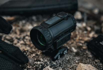
- Optical sights

- Rangefinders

- Gun flashlights and lasers

- Cleaning, maintenance

- Gun waist bags

- Shooting bags

- Shooting mats

- Boxes and cases for ammunition

- Training equipment for shooting

- Bullet traps

- Speed loaders

- Knives and Tools

- Self-defence

- Firearms and Ammunition

- Other

- By interest

Orientation in Nature: Complete Guide from GPS to Compass
Whether you’re crossing a mountain pass, venturing deep into the forest, or setting out on a multi-day trek, navigation skills in nature can prove invaluable. This guide takes you through both modern technologies and time-tested methods – GPS, mobile mapping apps, the compass and baseplate compass, as well as natural indicators of direction. With this knowledge, you’ll be able to find your way anytime, anywhere.
In this article, you’ll get acquainted with four key methods of terrain navigation:
- using digital technologies
- navigating without any tools
- using natural indicators
- using a compass and baseplate compass.
👉 Combining several of these methods is the surest way to avoid getting lost.

The Helikon-Tex® Ranger MK2 compass is a dependable tool for navigation in nature. Paired with a rugged notebook, it makes a practical duo for recording and planning routes.
🌍 Digital Navigation in Nature: From GPS to Mobile Apps
Modern navigation technologies – from GPS devices to smartwatches and mobile mapping apps – have made orientation in the field significantly easier. They provide accurate location tracking, route planning, and offline maps.
However, their main weakness lies in dependence on battery power, signal, and functioning hardware. That’s why, when traveling beyond civilization, it’s always wise to conserve energy (airplane mode, power-saving mode, disabling mobile data) and to carry a backup power bank.
Navigation with GPS Devices and Smartwatches
GPS devices and smartwatches provide precise location tracking, route recording with altitude data, and often the option to store offline maps.
Their disadvantages include occasional signal loss, lower durability of certain models in rugged terrain, and limited battery life. For longer trips, it’s best to carry a backup power source, such as a power bank, to reliably extend operating time.

The Tactical® C4 Explosive Power Bank (9600 mAh) paired with a waterproof phone case – a reliable duo for charging and protecting devices during outdoor adventures.
The Best Mobile Map Applications for Outdoor and Backcountry Navigation
For most outdoor activities in Europe, a mobile phone with a reliable map application is often the most convenient navigation tool. To ensure functionality even outside of signal coverage, download offline maps in advance, enable battery-saving mode, and keep a power bank at hand.
The following applications rank among the most popular and proven options for navigation in the field.
Best Mobile Map Apps for Outdoor and Backcountry Navigation
-
Maps.me
A mobile app based on OpenStreetMap data. Over the years, it has changed owners several times; the original developers created an alternative, Organic Maps, with no ads or trackers. Organic Maps provides offline maps with minimal battery consumption.
-
Gaia GPS
Offers topographic maps and advanced route planning, particularly strong in North America. It also works in other regions, though some specialized layers may be unavailable.
-
OsmAnd
An open-source application built on OpenStreetMap. Provides voice navigation for drivers, cyclists, and pedestrians, along with a robust offline mode.
-
Mapy.com
Originally Mapy.cz – a trusted Czech alternative well known to most local users. The Premium version is recommended, especially for offline maps that save both data and battery.
Satellite Communicators and Emergency Beacons: Navigation Without Signal
Satellite communicators and emergency beacons (PLBs – Personal Locator Beacons) are designed for situations where no mobile signal is available. Devices such as Garmin inReach, SPOT, or PLB can send SOS signals directly through satellite networks and summon help even from remote regions. They are useful for multi-day mountain hikes, sea voyages, or expeditions to areas with no coverage.
Some devices, like Garmin inReach, also enable sending text messages, photos, or voice messages without a mobile network. For most satellite communicators, however, you need to activate a subscription plan in advance to ensure full functionality in case of emergency.
Orientation with a Compass and Baseplate
The compass and baseplate are among the most reliable navigation tools. They require no batteries, work in any weather, and are unaffected by most terrain conditions.
A compass is used for quickly determining directions, while a baseplate compass combines directional functions with precise aiming and effective map work. Mastering proper technique in their use is essential for safe and accurate navigation.
Determining Cardinal Directions with a Compass
A compass works on the principle of a magnetic needle, which always aligns itself with magnetic north.
- Hold the compass flat in your hand, away from metal objects.
- Wait for the needle to settle.
- North is indicated by the tip of the needle marked “N.” Determine the other cardinal directions accordingly: south opposite north, east to the right, west to the left.
👉 TIP: Magnetic north differs from geographic (true) north – the difference, known as magnetic declination, is about 3–5° in the Czech Republic. For general orientation in the field this may not be critical, but for precise navigation it’s best to know the current value for your location.
Basics of Working with a Baseplate Compass
A baseplate compass provides all the functions of a standard compass, plus additional features such as:
- setting an azimuth using the rotating compass dial
- precise targeting of an objective through the sight or aiming wire
- working with a map using the built-in ruler and often a magnifying lens.
With a baseplate compass, you can navigate even without a map, but its greatest strength comes when combined with map resources.

On a multi-day hike, it’s worth carrying a spacious backpack with attachment points for a sleeping pad and other essential gear.
Determining Azimuth with a Compass
- Point the compass so that the direction arrow faces your target.
- Rotate the dial until the north end of the needle aligns with the “N” marking.
- Move in the chosen direction, regularly checking that the needle stays aligned with the dial as you walk.
👉 TIP: After walking for a while, it’s best to recheck your azimuth — it’s easy to drift off course.
Using a Compass with a Map
- Place the compass on the map so that the direction arrow points from your starting point to your destination.
- Rotate the bezel until its north line points to the north on the map.
- Orient the map in the field using the compass.
- You now have a precise azimuth to follow in the terrain.
👉 Note: To use this method, you must know your position on the map – navigate using recognizable landmarks.
- Always hold them flat and away from metal objects or electronics.
- Rotate the instrument, not your body.
- Practice using the compass even without a map.
- Be aware of the magnetic declination in your area.
- Protect the device from moisture and extreme temperatures.
Celestial Guides: Navigation by the Sun, Moon, and Stars
If you don’t have a compass, a baseplate compass, or working technology at hand, it’s useful to know how to orient yourself using celestial bodies alone. These methods are especially helpful if you can recall the area’s map at least roughly and know in which direction your destination lies.
Method of Orientation by the Sun
If you have an analog watch, it can serve as a valuable navigation tool. One of the simplest methods is to place a stick in the ground and wait for noon. At that moment, its shadow will point roughly north, allowing you to easily determine the other cardinal directions. Basic knowledge that the Sun rises in the east and sets in the west is also useful.
Another method is to use the watch directly: point the hour hand toward the Sun and then divide the angle between the hour hand and the number 12 in half. This dividing line indicates the approximate direction of south.
👉 Note: During daylight saving time, use the number 1 instead of 12.
Method of Orientation by the Moon
The illuminated part of the Moon shows where the sunlight is coming from, and thus provides an approximate sense of direction.
- A waxing Moon (the “arc” of light on the right) means that the Sun is – when you look at the Moon – on your right side, i.e., in the west.
- A waning Moon (the illuminated “arc” on the left) indicates that the Sun is on your left side, i.e., in the east.
- A full Moon occurs when the Moon is directly opposite the Sun. If you are walking toward the full Moon, you are moving roughly westward.
👉 Note: These rules apply to the Northern Hemisphere. In the Southern Hemisphere, the directions are reversed.
Method of Orientation by Stars
The night sky offers reliable reference points that can help you determine cardinal directions without technology. The most important star for navigation in the Northern Hemisphere is Polaris (the North Star). It sits almost directly above the North Pole and remains fixed in the sky throughout the night.
How to find Polaris:
- Locate the Big Dipper constellation.
- Focus on the two stars forming the “back wall” of its “bowl.”
- Extend the distance between these stars about five times in a straight line outward from the open side of the bowl. At the end, you’ll spot a bright star — this is Polaris.
Once you’ve found Polaris, you know you are facing north. From there, the other cardinal directions follow the basic scheme: south behind you, east to the right, and west to the left.
For better orientation, it also helps to recognize other circumpolar constellations (such as the Little Dipper, Cassiopeia, or Draco). These constellations never set in the Northern Hemisphere and can assist you if part of the sky is obscured by clouds or trees.

The Helikon-Tex® Ranger MK2 compass with luminescent markers makes navigation easier even in low visibility or at night.
Additionally: The Advantage of the Czech Landscape
One of the great advantages of the Czech landscape is its dense population. Even if you get lost, walking five to ten kilometers in one direction usually brings you back to civilization.
At night, you can navigate by the lights of villages, towns, or towers marked with red aviation beacons.
If you become disoriented in the mountains, follow the trail downhill into the valley – it will often lead to settlements or roads. Likewise, following a stream and continuing downstream can also guide you back to inhabited areas.
If you are considering spending the night outdoors, make sure you have proper gear (sleeping bag, insulating mat, shelter) and the knowledge to protect yourself against cold and moisture. Without these, it is usually safer to keep moving and search for a way back to civilization.
Spending the night without proper gear (sleeping bag, insulation, shelter) can lead to hypothermia even in mild weather.
- If you lack equipment and experience, it is safer to keep moving and seek shelter or civilization.
- Avoid getting wet and protect yourself from the wind — both factors sharply increase the risk.
🌍 Natural Terrain Indicators: How to Read the Landscape to Determine Cardinal Directions
Cardinal directions can be determined in nature even without a compass or modern technology. These methods are not 100% reliable on their own, but when several are used together and evaluated in context, they can be very accurate. The key is careful observation and cross-checking. Always consider the environment: is the tree growing near a wall? How might wind or moisture affect the conditions?
Moss and Lichens on Trees
Moss and lichens often grow more abundantly on the north side of tree trunks and rocks, where less direct sunlight reaches and humidity remains higher. This indicator works best in dense forests, where the difference between the sunny and shaded side is more pronounced.
Example: In a deep spruce forest, you may notice that the north side of tree trunks is consistently covered with moss, while the south side is drier and barer.
⚠️ Caution: In open landscapes or on trees exposed to wind and rain from all sides, this difference may not be visible. Moss may also grow more heavily on the side where rainfall is most frequent — which doesn’t necessarily indicate north.
Branches and Tree Crowns
In areas with abundant sunlight, trees often adapt to the sun’s direction. On the southern side (in the Northern Hemisphere), they tend to develop denser, longer branches, and the crown may lean slightly toward the south.
Example: A solitary oak standing at the edge of a meadow has branches on one side that are more sprawling and leafy. If this side faces the midday sun, it likely points south.
⚠️ Warning: This indicator is more reliable for trees growing alone or on the forest edge. In dense stands or valleys oriented differently, the crown’s shape may be influenced more by available space and light than by cardinal directions.
Sunflower Blossoms
Young sunflower plants turn to follow the sun during the day – in the morning the flowers face east, and in the evening they face west. Once the flowers mature, however, they typically remain facing east throughout the day.
Example: If you see mature sunflowers in a field and all the blossoms are oriented in the same direction, you are most likely looking east.
⚠️ Caution: This method only works during the flowering period and for plants growing in open areas. Orientation may also be influenced by the arrangement of rows in the field or by prevailing winds.
Anthills
Forest ants build their nests so that the southern side receives more sunlight. As a result, this side is usually more open, drier, and slopes more gently to the south. The northern side, on the other hand, tends to be wetter, more overgrown, and steeper.
Example: If you stand by an anthill and notice one side that is gentler, drier, and less overgrown, it is likely facing south.
⚠️ Warning: The shape and orientation of an anthill can be influenced by surrounding trees, slopes, or obstacles. Always verify with other natural indicators.
Tree Stumps and Growth Rings
Tree rings are typically wider on the southern side, as this part of the trunk receives more sunlight during growth. The south-facing wood is also often lighter and drier.
Example: When looking down at a tree stump, check which side has noticeably wider growth rings – that side most likely points south.
⚠️ Caution: The width of growth rings can also be influenced by other factors such as slope, water availability, or tree damage. Always verify the result with additional methods.
Melting of snow
In winter, snow melts more quickly on southern slopes and surfaces because they are more exposed to sunlight. Similarly, on the southern sides of trees, rocks, or buildings, there tends to be less snow, and the surface thaws more rapidly.
Example: if you are standing on a slope, compare the amount of snow on both sides – the side with less snow and more visible ground is likely facing south.
⚠️ Warning: snow melting can also be affected by wind, shade from surrounding objects, or human activity, so always combine this method with other indicators.
🌍 Conclusion: The Key to Safe Navigation – Combine Methods
Technology is a great aid, but it can fail — which is why it’s important to be prepared in advance and not be caught off guard in the field. Don’t rely solely on your phone or GPS; also master traditional methods that work without electricity or signal. You never know when the skills you’ve learned will prove invaluable.
- Combine traditional and modern navigation methods.
- Download offline maps before your trip.
- Practice orientation without technology — both alone and with children.
- Keep a “navigation pocket” in your backpack: map, compass, spare batteries.
- Verify direction using multiple indicators, not just one.
- Check the current magnetic declination for your location.
- Learn to recognize basic celestial and terrain indicators.


Readers are further interested